|
Day
1: July 28th, 2001 Finally the departure day was there, after more than 2 months of preperation, traing and planning. Our journey began with a train ride, a few wrong turns and an extra mountain to climb. |
|
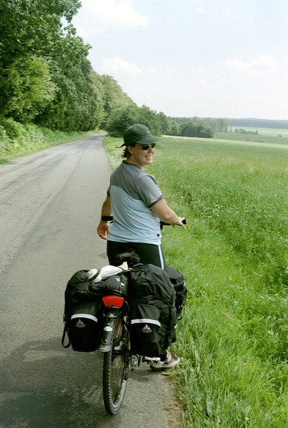
We took the 10:35 train from Amsterdam Amstel to Maastricht and arrived 13h. From Central station in Maastricht our trip officially began as we headed towards the Maas, crossed over the bridge and turned left. As we rode through downtown Maastricht, we went through a 'period of adjustment as we got used to reading the map while riding by missing turns, turning around and back tracking a few times. We missed a key right turn early on. This mistake cost us a mountain, or rather, added on to our journey. We had to ride up the only hill in Holland, the St. Pietersberg. Well, Lens rode up and halfway I said 'fuck it' and walked the rest of the way. I'd only been on the bike less then an hour, why struggle already? Because we had missed a turn earlier on, we had to back track a bit and ended up riding along the Albert kanaal, a huge chunk of rock cut out of the Pietersberg (where 'Mergel' that is used in making cement comes from..mmm who said this wouldn't be educational?)
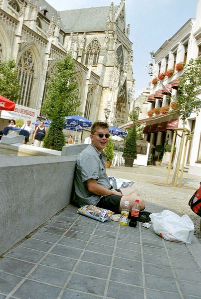
So, we crossed the Albert kanaal and ended going uphill again, 800meters/2624feet high. Once again, Lens rode up and I huffed and puffed as I walked (pushed / dragged / pulled / cursed) my bike up the long and windy road. The top of the hill gave way to a flat prairie land with fields of wheat and lettuce stretching into the horizon. From here it was straight through, following both route 87 and the Vlanderaan fiets route. We crossed the freeway (past knooppunt 87 into route 114) through a few villages and then into Tongeren. In Tongeren we found a large grocery store near the Kastana waal, called 'Super GB". We bought food for lunch and dinner then rode uphill to the town center. We went to the main square and sat on a fountain in front of a church and snacked while listening to a band rehears for an evening festival. That's one of the characteristics of riding through small towns I would come to enjoy. Every village has a center, with a church, town hall and a memorial. In the summer most villages have a village festival which is basically and excuse to have a party every year.
|
Day
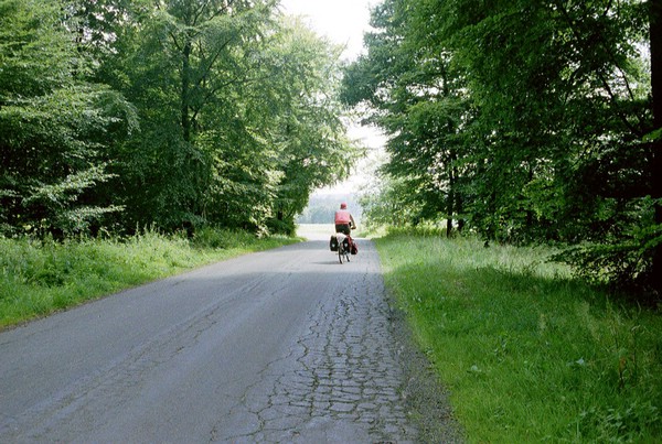
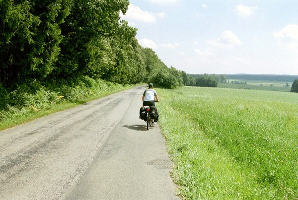
2: July 29th, 2001 Already starting to feel the intracasies of the outdoor life: getting up early because there is too much noise and the sleeping mats are not at all like a bed with a real matras. Didn't sleep much, it takes time to get used to sleeping in a tent. The roosters started cock a doodling around 5am. We were up at 7:30 and packed up and left at 9:30. We got lost almost immediately outside of Tongeren and decided to take a main road to our destination. The roads from the campsite to the main road to Huy were small bike paths that took you through a forest. Big huge leafy trees surrounded us on all sides, with occasional clearings cut away for a farm or cows. I can still see in my mind an image which I didn't take with my camera; that of a pasture, bordered by trees on all sides and a brown fence. There isn't much light since the trees cover the sky, giving everything a deep green and brown woodsy coloring. To one side, however in a small area, shafts of light broke through. In that small space were crammed 4 cows, trying to sun themselves. We probably cut 10-15km off our trip buy temporarily abandoning the route and taking the main road. The weather was great, 28-30C/82-26F and since we were off early it was still relatively cool.
|
| Day
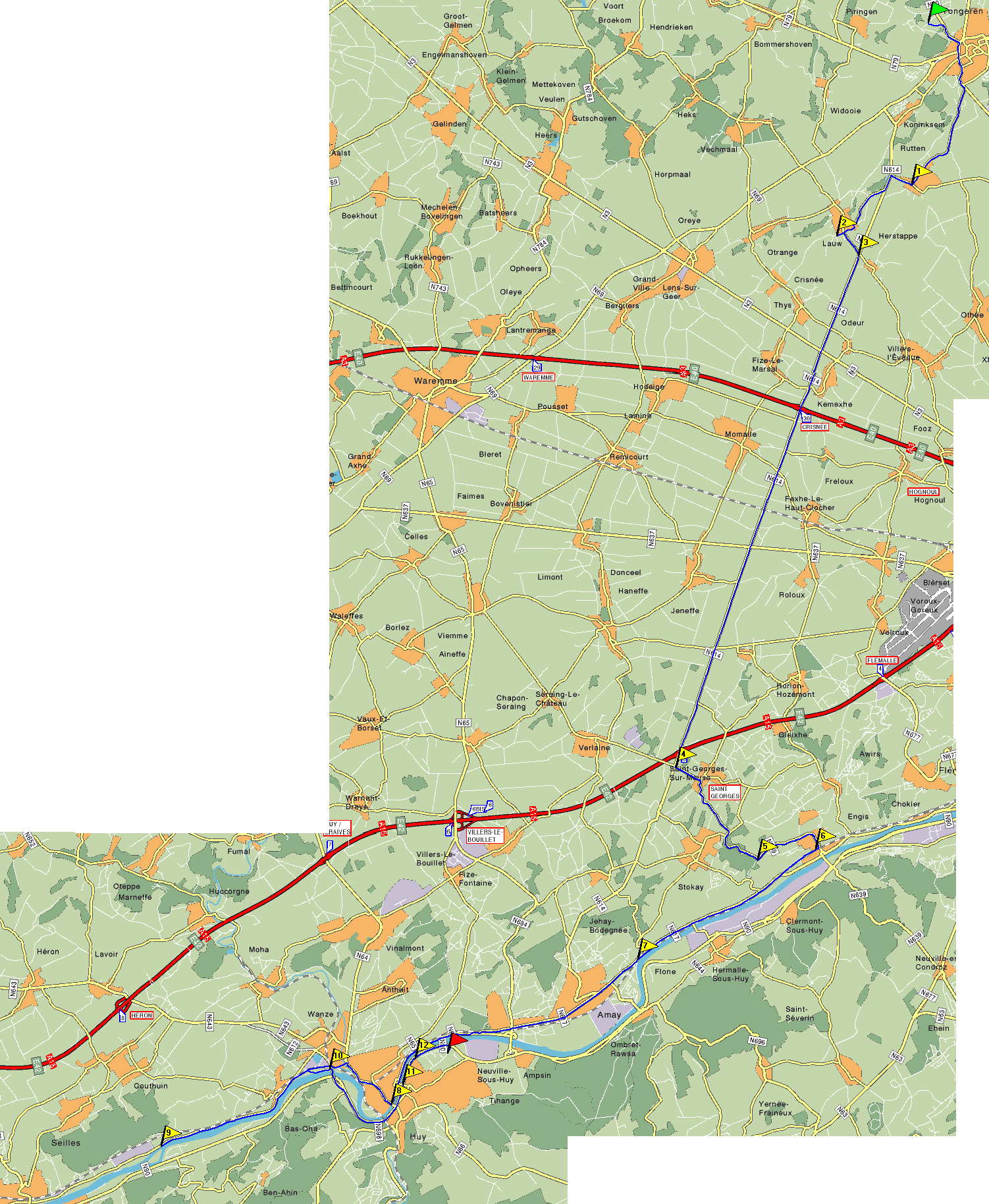
3: July 30th, 2001 Huy to Rochefort, Belgium Distance of the day: 62 km / 38.4 mi Total distance traveled: 114.9 km / 89.8 mi |
|
|
The first day of climbing, more heat ending in a swimmingpool which normally would have scared us away. We slept better last night, except for someone's alarm clock going off at 4am and were on our way by 8:30. We rode through downtown Huy, and stopped at a boulangerie and bought a fresh loaf of bread and a pain au chocolate (delicious). The route started off nicely, a flat, well paved path along the Maas (meuse) river. Lens had warned me in advance that today we had a 3km/1.8mi uphill climb. He probably thought it would give me time to prepare myself mentally for it. I had no idea what lie ahead. The first climb wasn't too bad; there were flat stretches on the long windy road that runs through the trees along with streams of running water. Half way up the hill is a wild animal park. Lens made it to the top, only stopping to wait for me. At least I think he made it to the top, the mountain seemed endless. Just when you thought you'd made it and were beginning to descend, there was another hill, only steeper. I couldn't ride to the top of any of them. I'd get halfway up and my knees would ache, like they were being stretched too far, and I would walk the rest of the way up. Lens was always at the top, waiting patiently, encouraging me and cheering me on. He did really well and I'm proud of him. Because today was Monday, stores don't open until 1:30. At 12:00, lunch time, we were almost out of water and in the town we were in, Pessoux, nothing was open. We decided to push on to the next town, hoping a store would be open so we could stock up. Half way there I crashed (not literally, I didn't fall off my bike, just boffed physically). I was probably going up a hill, it was 30C/86F and I was out of water. We got to the next town and found nothing. We had bread and cheese so we made sandwiches (again…) whilst sitting in the shade of a school yard. We desperately needed water so Lens gathered the water bottles (5 in total) and bravely ventured forth to a nearby house to ask if he could fill them up with tap water. The woman at the first house he went to insisted on giving him two large bottles of spring water and wouldn't accept Lens' protests. Bless her!
We rode on, up and down more hills. Lens is always the first one up and I am always the first one down. (I think I hit a top speed of 54kph/33.5mph going down one of the steeper ones) Just when we thought we were finished with the last hill of the day, about 9km/5.5mi from Rochefort, the mother of all steep climbs appeared before us. I swear I thought it was a ski lift when I saw it from a distance. Lens made it to the top, slow and steady, but I had to stop half way. This was a long, steep hill, and with my bike loaded up, pushing was no picnic. I had to stop every few feet to rest and drink more water. It was HOT! Lens saw me struggling up the hill and came to meet me on foot. He graciously took my bike and rode it the rest of the way uphill while I strolled up. Good man!
We rolled into Rochefort, very excited by the prospect that the campsite had a swimming pool. We stopped at the local super market , to get dinner, and then checked into the campsite. We set up our tent in record time, sweat seeping from every pore, and practically ran across the street to the community pool. You have to wear a Speedo and a bathing cap so we rented them (for Lens…I promised not to take a picture, but let me tell you it was a site!) and practically jumped into the pool (a testimony to how hot Lens was, since he HATES cold water). We swam for a long time, and then headed back to the campsite to have dinner and so some laundry. I learned two things about myself today: 1. My personal
hell is riding a bike loaded down with bike bags up a seemingly never
ending hill |
| Day
4: July 31st, 2001 Rochefort to Leglise, Belgium Distance of the day: 59 km / 36.6 mi Total distance traveled: 203.9 km / 126.4 mi |
|
We woke up early; it was difficult to sleep because in our haste to set up and get to the pool we set the tent up on a slope so that every time we moved on our mats, we slid down the right side (my side, unfortunately). We also learned that laundry should be done first thing so that it has time to dry. We left it out all night and it was still, if not more, wet. We set off at 9:30am and the climbing started almost immediately. It began easily enough, with a gradual slope. After a while, though, I had to walk. Thank god for Lens, who made it all the way on almost all the mountain climbs to the top (the highest one at 520 meters, just outside of St. Hubert). We stopped at St. Hubert for lunch. I decided that in this heat we shouldn't be cycling between 12 and 2 in the afternoon. St. Hubert was only 20km from Rochefort, but it took us 2 ½ hours to get there (LOTS of hills!)
We did a little shopping at the supermarket and went into the center (rather, we climbed up into the center) and stopped at a terrace for lunch. We sat there for 2 hours and watched people before setting off to climb what turned out to be the highest hill on the hottest day (isn't that always the way?) so far. The scenery was beautiful- rolling hillsides of forests thick with trees intermingled with farms and open fields. There were lots of cows chewing grass on the hillside and endless fields of wheat stretching into the horizon where they met the bright blue sky.
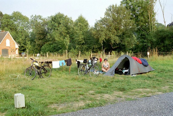
We finally made it into Leglise, after climbing more hills (they seemed endless today) and set up at the campsite which was actually on a working farm. The farmer was very friendly; when we arrived he gave Lens a glass of apple juice and asked about our trip and where we've been so far. Then the farmer personally showed him where to set up, where there was water and, most importantly, where the bathrooms were. A baby calf was born that afternoon next to the campsite. It was sweet to watch the mother clean her and start mooing when it stood up for the first time. We are dead tired, but on to Luxembourg tomorrow. |
|
Day
5: August 1st, 2001 |
|
|
We woke up feeling very tired. This was our fifth day in a row of cycling and we could feel it in our bones. Even Lens, happy go lucky Lens, was showing his pain. I tried to complain a little less to ease his suffering and be as encouraging as possible.
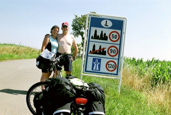
We aimed to stop for lunch at (some city I can't remember the name of now) but the place was a ghost town, only 2 banks and a bakery were open. Lens bought a loaf of bread and made a cheese sandwich. I had a power bar…I was getting tired of processed cheese sandwiches on a white bread at this point. With no terrace to be had, we pushed on to Clemency in hopes of finding a restaurant there for an afternoon break. On our way there we crossed into Luxembourg. What a place! Everything here is well maintained, most cars are new and houses are looked after with finely manicured lawns. We got to Clemency and found only a Chinese restaurant, not ideal biking food, and decided to press on.
We came to a roundabout and took a break under the shade of a tree. It was HOT! We were 14km (about 8.6miles) from Bettenbourg where the campsite is located, and 11 km (6.8 miles) from Luxembourg town, the capitol of the Grand Duchy of Luxembourg. At this point we were tired and getting hungry and decided we had a better chance of finding food in the capitol…and why we were in Luxembourg, why not spend our rest day in a hotel? With the motivation of a bed and shower you didn't have to feed coins into, we were off.
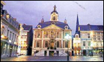
We rolled into town and went immediately towards the center. We saw a McDonalds and decided to relax there while we figured out where we would stay. On the Place d'Armes (by the McDonalds) is an info center. Lens went in and came out with a list of hotels. He tried the first one around the corner, a new place called 'Casanova' (info@hotelcasanova.lu / +35 2220493) on the Place Guillame and they had a room for us, and even stored our bikes while we stayed there. Ahhh, sweet relief. We lay down on the bed and sighed in ecstasy. This was a real bed, not a sleeping bag on top of a sleeping mat in a small and confined space. My friend Jenny moved to Luxembourg from Amsterdam 2 years ago. She lives 12km (7.5mi) from the city in a beautiful house with husband Peter and two kids, Thom and Sophie. She came into town to pick us up and took us back to her house, bless her heart, and made us dinner while we did some much-needed laundry. She knew we had made it into Luxembourg before we called her because a friend of hers had driven by us while we were cycling into town. She called Jenny and said she saw "two bicyclists, one man and one woman, with red bags and black bags, looking very tired". It was us! Luxembourg really is a small country. Tomorrow is a rest day. No biking! |
Copyright 2001-2002 Maarten
& Lori Lens-FitzGerald